


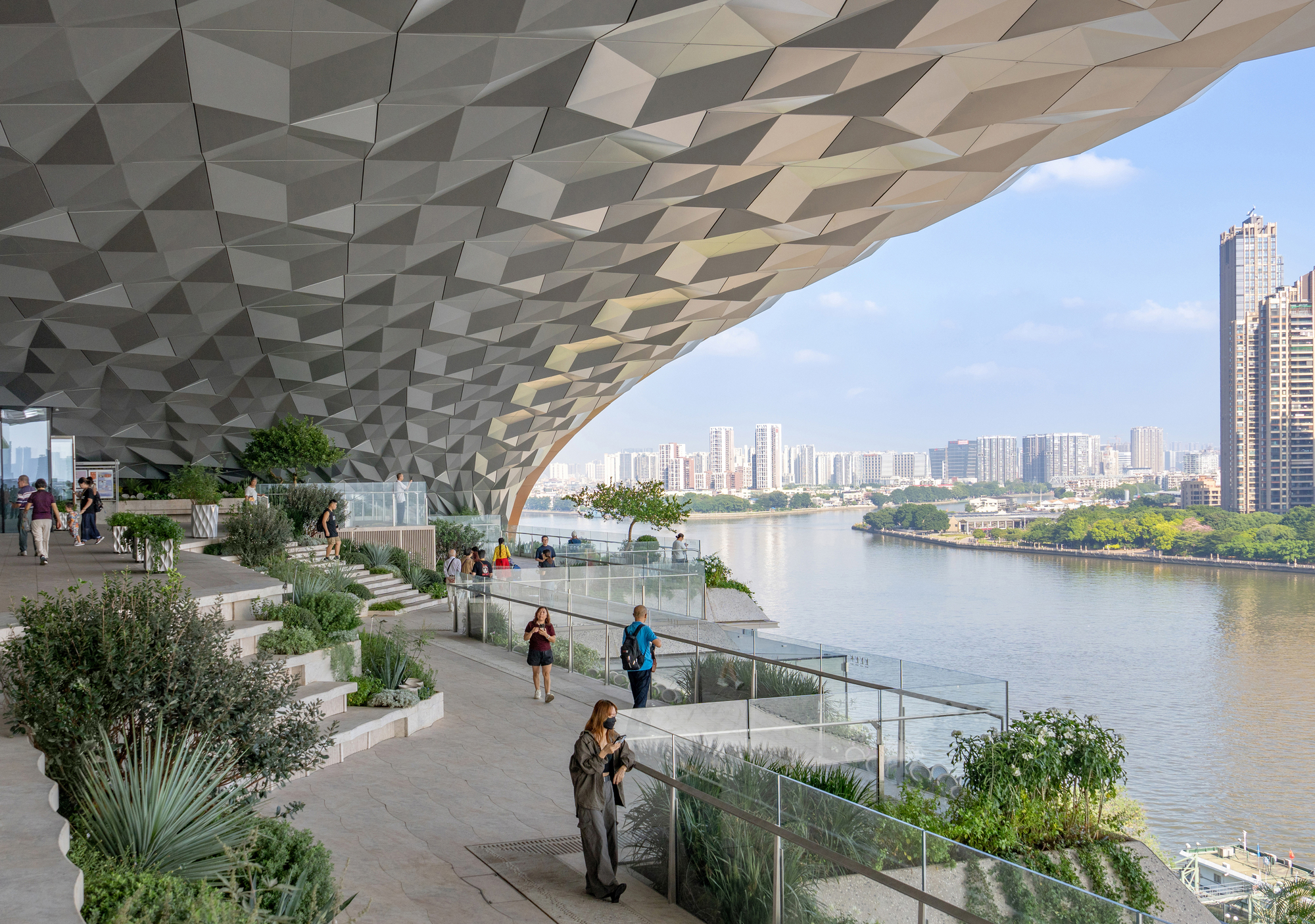

On the banks of the Pearl River, Agence TER uses ten hectares of public landscape to connect the metro, a historic district and the daily life of Guangzhou with the water.
The setting
In Bai’etan, a trip to the river can begin at the metro exit. From there, the landscape links neighbourhood squares, housing, schools, a sports hall and the MIXC shopping complex. The design challenge was specific: to make these journeys continuous across a site where ground levels, building scales and the intensity of pedestrian traffic all change.
The 100,000 m² landscape sits in Liwan, within a much larger area of urban change. The district government identifies four subareas in the Bai’etan Central Business Zone and records 13 kilometres of shoreline across the zone. Closer to the site, Guangzhou’s planning bureau places the MIXC development within a network of landmarks that includes the Greater Bay Area Art Center, the historic Shamian district and the riverfront squares. That wider network provides the urban context for Agence TER’s work.
Find Bai’etan MixC on the map ↗
The design
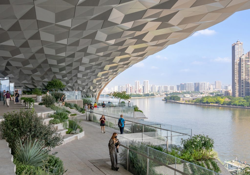
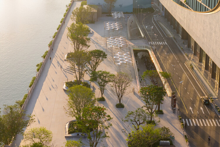
The waterside path creates a continuous route along the length of the park. The routes across the district serve a different purpose: they give people coming from the metro or the neighbourhood a way to reach the water. Between those two directions, the network takes in street-level squares, sunken spaces, terraces and rooftops. In section, the riverfront becomes part of a landscape with several levels, where elevation matters as much as distance.
Agence TER draws on erosion and sedimentation in shaping the ground and its surfaces. A terrace above the promenade can open up the view; in a sunken space, the ground and its edges come back into close range. These shifts make the river’s presence legible in the shape of the route, even before the water comes into view.
The proximity of historic buildings and new construction raises another question: which spaces can be shared by the people who pass through the area every day? In Guangzhou’s hot, humid climate, the brief included making it comfortable both to walk and to stop. Continuity matters for what it makes possible: the same square can carry people home after school and give neighbours somewhere to meet later in the day.
Interactive walkthrough
Open each part of the walkthrough to see how the relationship between the city, the ground and the river changes. The sequence is an interpretation of the project drawings.
From the neighbourhood to the water
Follow the cross-district routes in the axonometric drawing. Look for the links between transit entrances, the squares and the riverfront. These connections make the river an everyday destination for people approaching from inland.
Along the riverfront
Read the park lengthwise. The promenade connects places to pass through with places to linger. Notice where paths from the neighbourhood join this continuous route.
Between levels
Compare street level, the sunken squares and the terraces in the section. Changes in height affect how far people can see and how they experience the edges of public space.
Gallery and drawings
Explore the axonometric drawing ↗ Explore the section ↗ View the complete gallery on ArchDaily ↗
Project credits
- Landscape architecture · Agence TER
- Lead architect · Kai DIAO
- Location · Liwan, Guangzhou, China
- Area and year · 100,000 m² · 2026
- Photography · IAM岸木摄影
See the full team and consultants
- Design team · Adèle Meidine, Jiaxin Li, Abderrahmane Nachda, Yifan Huang, Xueyan Liu, Yirong Ma, Siyuan Wang, Wencan Fu, Nguyễn Gia Khoa, Julie Ducros, Ali Hamze, Lucas Huvet, Ziyun Zhou, Zhuoran Chen, Huimin Yang, Na Zhang, Hao Yu
- Urban planning · Urbanus!
- General contractor · China Resources Land
- Civil engineering · Pubang Landscape Architecture Co., Ltd.
- Structural engineering · Arup
- Lighting · TS Lighting
- Other consultants · EBOND
 Estudio EA